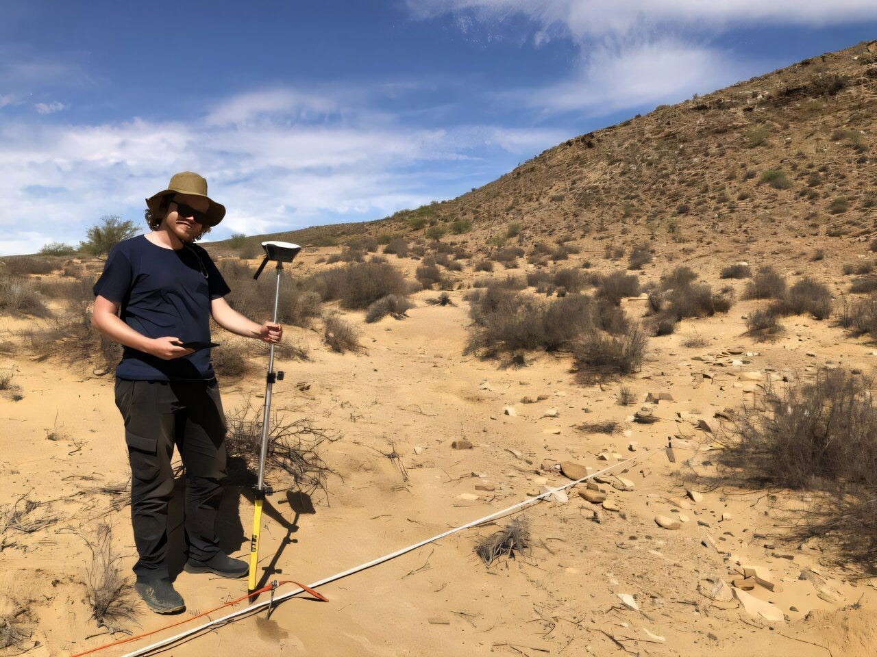
For years, the story of human evolution in southern Africa has been largely written from its caves. Rock shelters, with their stable conditions and stratified sediments, have preserved a rich archaeological record. But they represent only a narrow view. Outside the cool embrace of stone overhangs lie thousands of open-air sites, scattered across eroded plains, riverbanks, and dunes—sites that are far more difficult to study, but no less crucial for understanding how early Homo sapiens lived and moved across the land.

At Klein Hoek 1 (KH1), a Middle Stone Age open-air site nestled beside the Doring River in South Africa, researchers have been trying to break that bias. The site has yielded more than 180 bifacial points associated with the Still Bay technocomplex, a cultural marker of the early emergence of symbolic behavior and sophisticated tool production between 75,000 and 70,000 years ago. But until recently, much of the archaeology at KH1 had been exposed by erosion, with key contextual information stripped away by wind and water.
In a new study1, archaeologists from Flinders University and their collaborators applied two geophysical techniques—electrical resistivity tomography (ERT) and magnetometry—to KH1, seeking a better understanding of the site’s buried layers. Their goal wasn’t just to find artifacts, but to make sense of the stratigraphy, the history of sediment movement and deposition, and the buried footprints of ancient fire.
“Caves give us detail, but not the full picture,” said Ian Moffat, a geoarchaeologist at Flinders University. “Most of the archaeological landscape was open, not sheltered. We need tools that let us see beneath the surface without digging everything up.”
Stratigraphy Without a Shovel
ERT works by injecting small electrical currents into the ground and measuring how easily the current moves through different subsurface materials. At KH1, ERT revealed four major layers: loose surface sands, semi-consolidated aeolian sediments, a layer of cobble-rich fluvial sediment, and, deep below, the ancient bedrock. The semi-consolidated sands, which had previously yielded Still Bay points, turned out to be up to 8 meters thick.
This was a revelation. Surface finds were just the tip of the iceberg. Within that thick band of sediment could lie untouched deposits from tens of thousands of years ago—preserved, stratified, and still in situ.
“That sediment body is where the archaeology lives,” said Oliver Hatswell, lead author of the study. “But you wouldn’t know it just by looking at the surface.”
Magnetic Echoes of Ancient Fires
Magnetometry, the second technique, scans the soil for tiny magnetic anomalies, especially those created when humans built hearths or burned organic material. These changes, caused by the transformation of iron-bearing minerals under heat, can linger for millennia.
At KH1, the researchers found subtle but meaningful magnetic variations scattered across parts of the site—areas not previously associated with surface artifacts. These quiet blips in the magnetic data may represent ancient fire pits, campsites, or other human activity.
“You start to see a pattern,” said Moffat. “Where the magnetometry says there was heat, there’s often a correlation with known tool concentrations. That opens up new excavation targets.”
A Site in Two Worlds
KH1 is divided by a fence line. To the west, erosion has stripped the land, revealing artifacts but destroying their stratigraphic context. To the east, sediments are well-preserved but show few signs of archaeology at the surface.
Geophysics bridges that divide. In the east, ERT revealed thick, intact layers of aeolian sediment—suggesting the possibility of deeply buried archaeology. In the west, magnetometry highlighted potential hearths among known tool clusters. Together, the methods map out both horizontal and vertical paths for future excavation.
This duality reflects a broader challenge in African archaeology. Open-air sites are both revealing and concealing. They show the past where it’s been disturbed. They hide it where it’s preserved. Bridging that tension requires tools that see what the eye cannot.
Toward a Broader Landscape Archaeology
The Still Bay points at KH1 are more than just tools. They are artifacts of cognition, of cultural tradition, of people living and making meaning in a landscape. But to understand those lives, archaeologists must situate the tools in space and time.
This study shows that geophysical methods—long a staple in European archaeology—are just as valuable in southern Africa. With the right equipment, researchers can find the invisible stratigraphy of human life in places where digging alone won’t do.
“Open-air sites are no longer second-class citizens in archaeology,” said Hatswell. “With geophysics, they’re just as rich—if not richer—than the caves.”
Related Research
-
Ames, C. J. H., et al. (2020). Evaluating erosional impacts on open-air archaeological sites along the Doring River, South Africa: Methods and implications for research prioritization. Archaeological and Anthropological Sciences, 12, 103. https://doi.org/10.1007/s12520-020-01061-x
-
Phillips, N., et al. (2023). Sedimentary processes and preservation at the open-air MSA site of Uitspankraal 7, Western Cape, South Africa. Geoarchaeology, 38(1), 21–48. https://doi.org/10.1002/gea.21873
-
Mackay, A., et al. (2023). Geophysical investigations at Klipfonteinrand rock shelter. South African Archaeological Bulletin, 78(207), 9–19.
-
Fuchs, M., et al. (2008). Geoarchaeological and chronostratigraphical investigations of open-air sites in the Geelbek dunes, South Africa. Geoarchaeology, 23(4), 425–449. https://doi.org/10.1002/gea.20226
-
Herries, A. I. R., et al. (2023). Stratigraphy and site formation at Amanzi Springs, South Africa, based on geophysical survey. Quaternary International, 658, 1242–1258. https://doi.org/10.1016/j.quaint.2022.07.012
Hatswell, O., Moffat, I., Ames, C. J. H., Shaw, M., Phillips, N., McNeil, J.-L., Jones, B. G., & Mackay, A. (2025). Understanding the depositional history of the archaeological open‐air site, Klein Hoek 1, South Africa, using geophysical geoarchaeology. Geoarchaeology, 40(3). https://doi.org/10.1002/gea.70015