Goat Mountain East Peak stands by Mount Sefrit in the Mount Baker Wilderness of the North Cascades. It perches above the Nooksack River, north of the iconic Mount Shuksan. The historical significance of this peak is tied to the nearby Silver Tip Mine, which produced silver and gold in the 1940s. Together with the west peak, they offer expansive and truly breathtaking alpine views.
See more trip photos here.
Goat Mountain East Peak at a Glance
Access: Goat Mountain Trailhead
Round Trip: 10.7 miles
Elevation Range: 2440′-6889′
Essential Gear: helmet, microspikes, snowshoes, ice ax, crampons
Route Info: Scott Rice
GPS Track: available
Dog-Friendly: with guidance
Playlist: Beats
Early Approach on Goat Mountain Trail
Cody, the yellow lab, and I had eyed Goat Mountain from other vantages nearby. But Connor got lucky, as I finally decided on the adventure over the long weekend. Coincidentally, it was among the popular ones of the nearly dozen “Goat Mountains” in Washington State. After a restful day at Picture Lake, drying gear from the Mount Sefrit climb, we car-camped off Nooksack Road. As we started early the next morning, I noticed the car from the previous night in the lot.
The initial well-maintained trail included many switchbacks, easing the steep incline to 3200 feet. Afterward, the path stretches nearly a mile before the next set of switchbacks. During this flatter section, the trail dipped slightly, passing a pool of downed trees on the forest floor. A couple of fallen, skinny logs across our way were easy to step over. Several short wooden walkways soon led us toward a beautiful, low-incline waterfall, intersecting the trail several times.
Entering the Wilderness and Changing Terrain
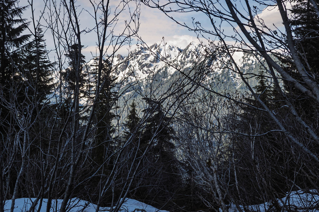
The path crisscrossed the beautiful waterfall a few times before we left the refreshing splashes behind us. Soon, at mile 2, a sign on the tree officially welcomed us into the Mount Baker Wilderness. We encountered numerous small streamlets before snow patches began to appear around 4200 feet. Through tree branches, early glimpses of Shuksan Arm and the Artist Point area quietly arose.
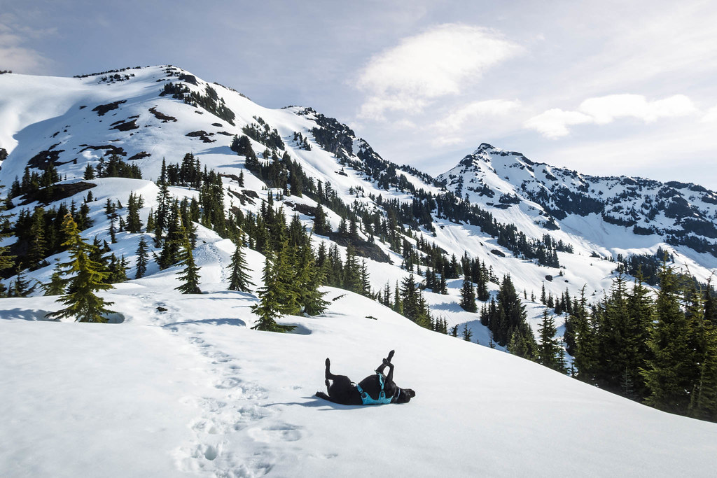
A couple of weakening snow bridges tested our footing before the clearing, which marked the start of continuous snow. From here, alluring views of Goat Mountain West Peak began to emerge, motivating us onward. We took advantage of the snow cover and soon left the campers’ tracks in the meadow. The goal was to ascend more directly toward the mountain’s south shoulder and ridge. With his usual energetic snow rolls, Connor seemed to agree with this choice.
Brief Detour Around False Summit
At a flat area around 5500 feet, I slipped on snowshoes in softening snow. It would also be our return point after looping through Goat Mountain East Peak. Old snowshoe tracks soon faded as we made a beeline for the false summit of the west peak. Meanwhile, the expansive south view continued to unfold behind us. But upon recognizing that we were near cornices, we meticulously retraced our steps down toward the west. A quick look around the snow-draped ridgeline, and we dropped slightly into the top of the west basin.
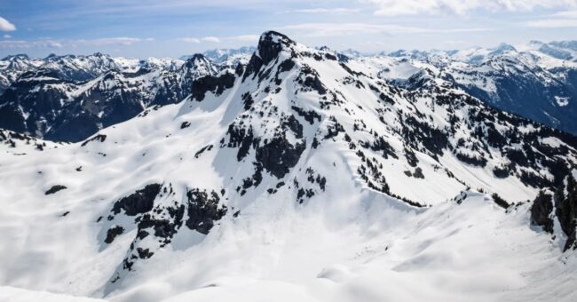
The detour allowed us to bypass the tricky false summit, directly for the south notch of the west peak. Connor enthusiastically led the final, brief walk to the top of the snow-covered high point. We steered clear of the cornices spanning the east rim while sticking to the sloped dry ground. Here, the incredible views encompassed Mount Sefrit, Mount Larrabee, plus many familiar border peaks. Meanwhile, a little over half a mile away, the east summit of Goat Mountain beckoned.
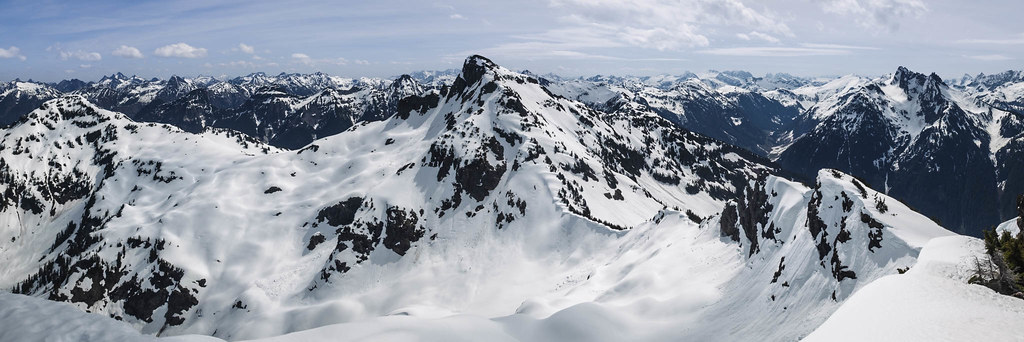
Traverse to Goat Mountain East Peak
Now, with crampons, I faced inward and carefully placed a few steps over the north snow arête. Connor and I then gained the pristine, powdered ridgeline using Scott Rice‘s GPS track from 2022. We slowly dropped into the east basin before switching to snowshoes for the traverse to Goat Mountain East Peak. From the east shoulder, the steep south rib, a mixture of trees and rocks, looked unappealing. The sheer outcrops overlooking the 6100-foot saddle also weren’t feasible due to the cornice condition.
Ultimately, we returned to the top of the glacier on the north side. Carefully navigating through the bottom of old snow releases, we soon reached the broad saddle. But to avoid open, exposed terrain and cornices, we zigzagged through tree clusters while hugging the steep west ridge. At 6600 feet, it was necessary to bypass the sheer outcrops by slowly moving onto the south slope. The final ascent involved a sustained incline through snow and rocks to reach this higher summit of the day.

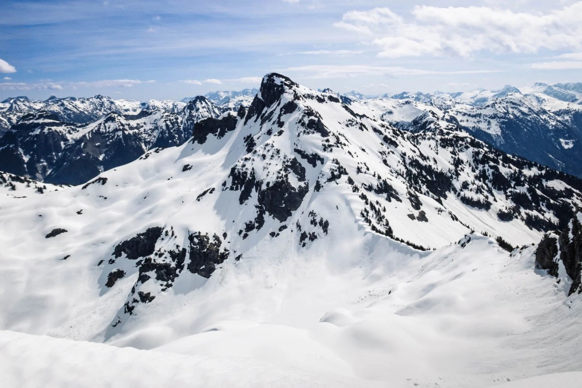
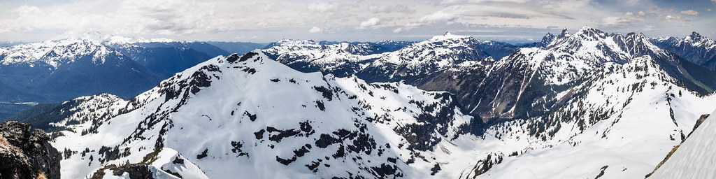
Summit Views and Descent
The stunning panoramic views of the surrounding North Cascades from Goat Mountain East Peak were similar to the West. Vistas included the familiar Slesse Mountain in Canada, Chilliwack high points, and the Picket Range. Looking back at Mount Sefrit from two days earlier felt incredibly surreal. A while later, Greg from Maple Valley arrived, having decided to skip the west peak due to time constraints. He and I then chatted for a long time, sharing stories of our respective climbs, before bidding goodbye.
For the descent, Connor and I retraced our route in crampons to 6200 feet. Then, we followed Greg’s boot tracks toward the 5500-foot flat area where the snowshoes first went on this morning. We noticed more fresh tracks in the meadow, evidence of others enjoying the scenery while we were higher up. We took our direct trail before rejoining the main path at 5000 feet. Soon, it was back to the forest and eventually out on dry ground.
The post Goat Mountain East Peak by Mount Sefrit via Nooksack River / 山羊山 appeared first on One Hike A Week / 每週一行.